A geotechnical survey & investigation is conducted on a construction site primarily to obtain data about the subsurface soil and rock conditions of the proposed site. It helps the foundation engineers to understand the basic foundation requirements for the construction of any proposed infrastructure, such as roads, buildings, bridges, dams & hydraulic structures, retaining walls, underground utilities, and parking areas.
Geotechnical surveys & investigations are essential for foundation and structural engineers in recommending design criteria for the construction and design approach of any proposed project.
History of Geotechnical Survey & Investigation
In human history of geotechnical survey & investigation, the soil has been used as a material for flood control, irrigation purposes, burial sites, building foundations, and as construction material for buildings. First activities were connected to irrigation and flood control, as demonstrated by traces of dykes, dams, and canals dating back to at least 2000 BCE that were found in ancient Egypt, ancient Mesopotamia, and the Fertile Crescent, as well as around the early settlements of Mohenjo Daro and Harappa in the Indus valley. As the cities continue to be expanded, structures were erected and supported by formalized foundations; like the ancient Greeks’ construction of pad footings and strip-and-raft foundations. Until the 18th century, however, no theoretical basis for soil design had been developed and the discipline was more of an art than a science, relying solely on experience.
The modern geotechnical survey & investigation engineering are said to have started as far back as 1925 with the publication of Erdbaumechanik by Karl Terzaghi who was a renowned mechanical engineer and a geologist. He is considered by many to be the father of modern soil mechanics and geotechnical engineering, Terzaghi was the first to develop the principle of effective stress and demonstrated that the shear strength of soil is controlled by effective stress. He also developed the framework for many other foundations’ bearing capacity and the theory for predicting the settlement rate of clay layers’ settlement as a result of consolidation.
Shortly afterward, Maurice Biot fully also developed the three-dimensional soil consolidation theory, extending the one-dimensional model previously developed by Terzaghi to more general hypotheses and introducing the set of basic equations of Poroelasticity. In 1948, in his book, Donald Taylor recognized that the interlocking and dilation of densely packed soil particles will impact the peak strength of a soil. The interrelationships between volume change behavior such as consolidation, dilation, contraction, and shearing behavior were all connected through the theory of plasticity using critical state soil mechanics by Roscoe, Schofield, and Wroth in their publication of “On the Yielding of Soils” in 1958.
The Critical state soil mechanics is the foundation for many contemporary advanced constitutive models describing the behavior of soil.
What is Geotechnical Survey & Investigation?
Geotechnical survey & investigation is the process of obtaining geological data or information on the physical properties of soil for earthworks and foundations of proposed structures and repairs of distressed earthworks and structures caused by subsurface soil conditions. This type of survey is popularly known as site investigation. Geotechnical survey & investigation can be conducted to measure the thermal resistivity of soils or backfill materials required for underground tunnels, retaining walls of basement floors of buildings, underground transmission lines, oil and gas pipelines, and solar thermal storage facilities, and radioactive waste disposal.
A typical geotechnical survey & investigation will include surface exploration and subsurface exploration of the proposed site. In some cases, geophysical methods are used to obtain valid geotechnical data about sites which are known as surface exploration, and subsurface exploration usually involves soil sampling and laboratory tests of the soil samples collected from the site. Geotechnical surveys & investigations are usually performed by engineering geologists or geotechnical engineers
Geotechnical Survey & Investigation Procedures
The following are the procedure for geotechnical survey & investigation:
- Surface and subsurface exploration
- Soil and water sampling
- In situ tests
- Laboratory analysis.
Surface and Subsurface Exploration
Surface exploration in geotechnical survey & investigation involves geotechnical surface reconnaissance such as geophysical exploration, geologic mapping, and photogrammetry, or it could be as simple as a geotechnical engineer walking around the proposed site to identify the physical conditions of the site such as soil type, the strength, and density of the soil, any organic material or contamination present, groundwater, and soil compaction. While subsurface exploration on the other hand has to do with soil sampling and laboratory tests of the soil samples collected from the site.
Geotechnical Soil Sampling
Soil samples for geotechnical surveys & investigations are usually categorized as disturbed or undisturbed, however in a practical sense, “undisturbed” samples are not undisturbed. A disturbed soil sample is one in which the structure of the soil has been changed or tempered significantly to the degree that the tests of engineering properties of the soil may not represent the actual in-situ conditions of the soil, and it is only properties of the soil grains such as grain size distributions, compaction characteristic of soil, Atterberg limits, to determine the entire lithology of soil deposits and possibly the water content can be accurately determined.
An undisturbed sample on the other hand is one where the condition of the soil sample is close enough to the in-situ conditions of the soil that can allow tests of the structural properties of the soil to be used to approximate the properties of the in-situ soil. Generally, soil specimens for geotechnical survey & investigation obtained by the undisturbed method are usually used to determine the soil stratification, density, permeability, consolidation, and other engineering properties.
Most Offshore soil collection in geotechnical surveys & investigations introduces many difficult variables. In shallow water cases, work can be done off a barge, and in deeper water cases, a ship will be required. The deepwater soil sampler is a variant of Kullenberg-type samplers, with some modifications on the basic gravity corer using a piston and the seabed samples are also available, which pushes the sample collection tube slowly into the soil for the sample collection.
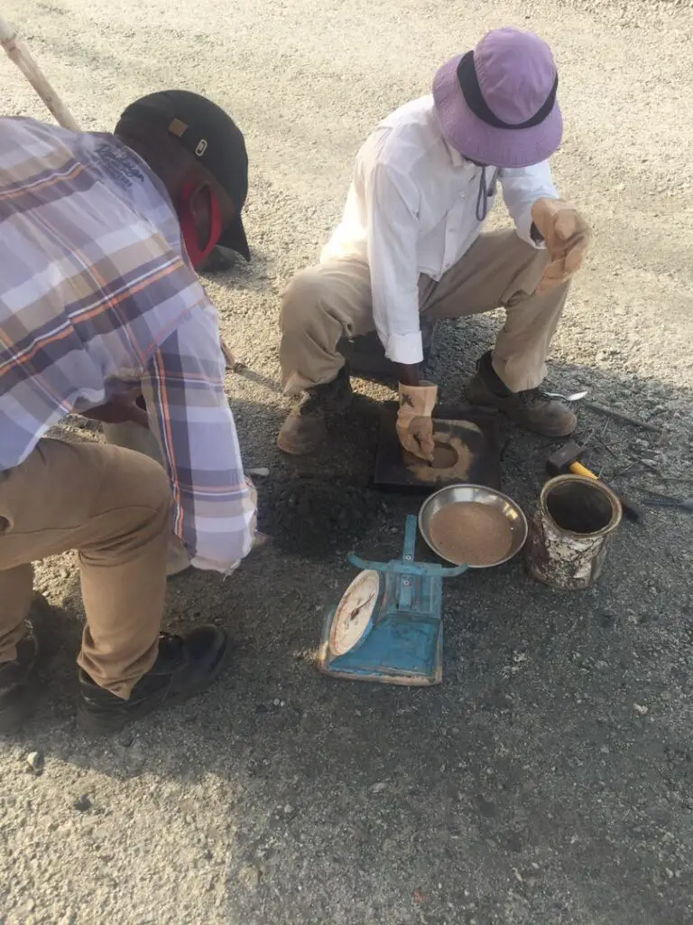
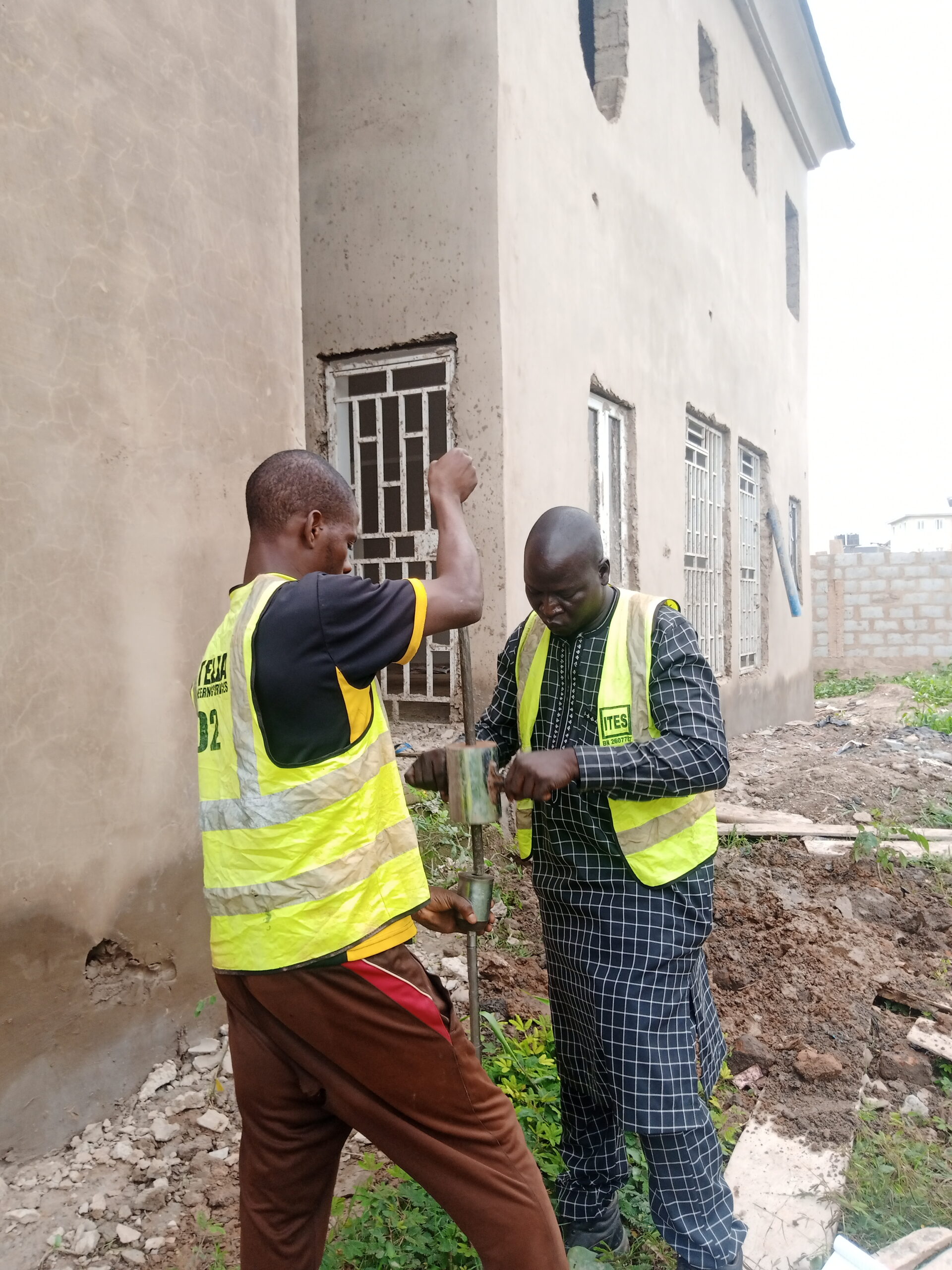
In situ tests
In situ tests for most geotechnical surveys & investigations involves the use of many different tools and methods depending on the survey requirements such as the followings:
- Standard penetration test: This is an in-situ dynamic penetration test designed to provide information on the geotechnical properties of soil, which also is used in collecting a disturbed soil sample for soil classification and grain-size analysis.
- Dynamic cone penetrometer test: This is also an in situ soil test in which the sample weight is manually lifted and dropped on a cone penetrometer. The number of millimeters per hit is recorded and used to determine some of the soil properties. This is a simple test method but needs the backing of lab data to get a good correlation.
- A Cone penetration test (CPT): is also in situ test performed using a probe instrument with a conical tip, pushed into the soil by hydraulic force at a constant rate. A common CPT instrument reports the tip resistance and the shear resistance along the cylindrical barrel. Cone penetration test data has been correlated to soil properties.
- A piezocone penetrometer probe: Other than the basic CPT most advanced in situ tests are carried out using the piezocone penetrometer probe which is similar to the regular CPT probe but has an additional instrument that measures the groundwater pressure as the probe advances.
- A seismic piezocone penetrometer: This is also an advanced CPT type using the same equipment as a CPT or CPTu probe, but also equipped with either accelerometers or geophones that detect shear waves or pressure waves produced by a source at the surface.
- Full flow penetrometers (T-bar, ball, and plate) probes: These are used in extremely soft clay soils such as sea-floor deposits and are also advanced as the CPT. The T-bar is a cylindrical bar attached at right angles to the drill string forming what looks like a T, the ball is a large sphere, and the plate is a flat circular plate. In soft clay areas, soil usually flows around the probe just like a viscous fluid. In this case, the pressure due to overburden stress and pore water pressure is always equal on all sides of the probes when compared to that of CPTs, with this, corrections are not necessary, thereby reducing the possible sources of errors and increasing accuracy.
- Helical probe test soil exploration and compaction testing by the helical probe test (HPT): This has become very popular among geotechnical engineers and geologists for providing a quick and accurate method of determining soil properties at relatively shallow depths. The HPT test is very attractive for in-situ footing inspections due to its lightweight and can be conducted quickly even by one person. During testing, the probe is driven to the desired depth and the torque required to turn the probe is used as a measure to determine the soil’s characteristics.
- A flat plate dilatometer test (DMT): is also a flat plate probe often advanced to CPT rigs, but can also be advanced compared to conventional drill rigs. It has a diaphragm on the plate that applies a lateral force to the soil materials and measures the strain induced for various levels of applied stress at the desired depth intervals.
In-situ tests for geotechnical survey & investigation can also be carried out for gas tests and can be done in the boreholes on completion and in probe holes made in the sides of the trial pits as part of the site investigation. Testing is normally with a portable meter, which measures the methane content as its percentage volume in air. The corresponding oxygen and carbon dioxide concentrations are also determined.
Laboratory Analysis
There is a wide variety of laboratory tests that can be carried out during geotechnical surveys and investigations on soils to find a wide variety of soil properties. Some of the soil properties are intrinsic to the composition of the soil structure and are can not be affected by sample disturbance, while other soil properties depend on the structure of the soil as well as its compositional matrix, and can only be effectively analyzed on a relatively undisturbed sample basis. Some of the soil tests are carried out to determine the direct properties of the soil, while others are to measure the soil index properties which provide useful data about the soil without measuring the desired properties.
Geotechnical Survey & Investigation Soil Samplers
Geotechnical survey & investigation soil samplers are varieties of tools used for the collection of soil samples. Some of these tools provide relatively undisturbed soil samples, while others can provide only disturbed soil samples. Below are common geotechnical survey & investigation soil samplers:
- Shovel
- Hand/Machine Driven Auger
- Modified California Sampler
- Piston samplers
- Continuous Flight Auger
- Shelby Tube Sampler
- Split-spoon / SPT Sampler
- Piston sampler
- Trial pits
- Pitcher Barrel sampler
What is geotechnical soil sampling?
Geotechnical soil sampling is the process of collecting soil samples from a proposed site for a geotechnical soil analysis to ascertain the geological and engineering properties of the soil.
Why are geotechnical surveys important?
Geotechnical surveys are carried out to critical soil data and to ascertain the soil condition and geological properties to help the geologist and foundation engineers to understand the basic foundation requirements for the construction of any proposed infrastructure, such as roads, buildings, bridges, dams & hydraulic structures, retaining walls, underground utilities, and parking areas.
What are the stages of site investigation?
The following are the stages for geotechnical investigation:
1. Surface and subsurface exploration
2. Soil and water sampling
3. In situ tests
4. Laboratory analysis.
How long does it take to complete geotechnical investigations?
Geotechnical investigation can take between two weeks to two months to complete depending on the scope and the magnitude of the project.
